


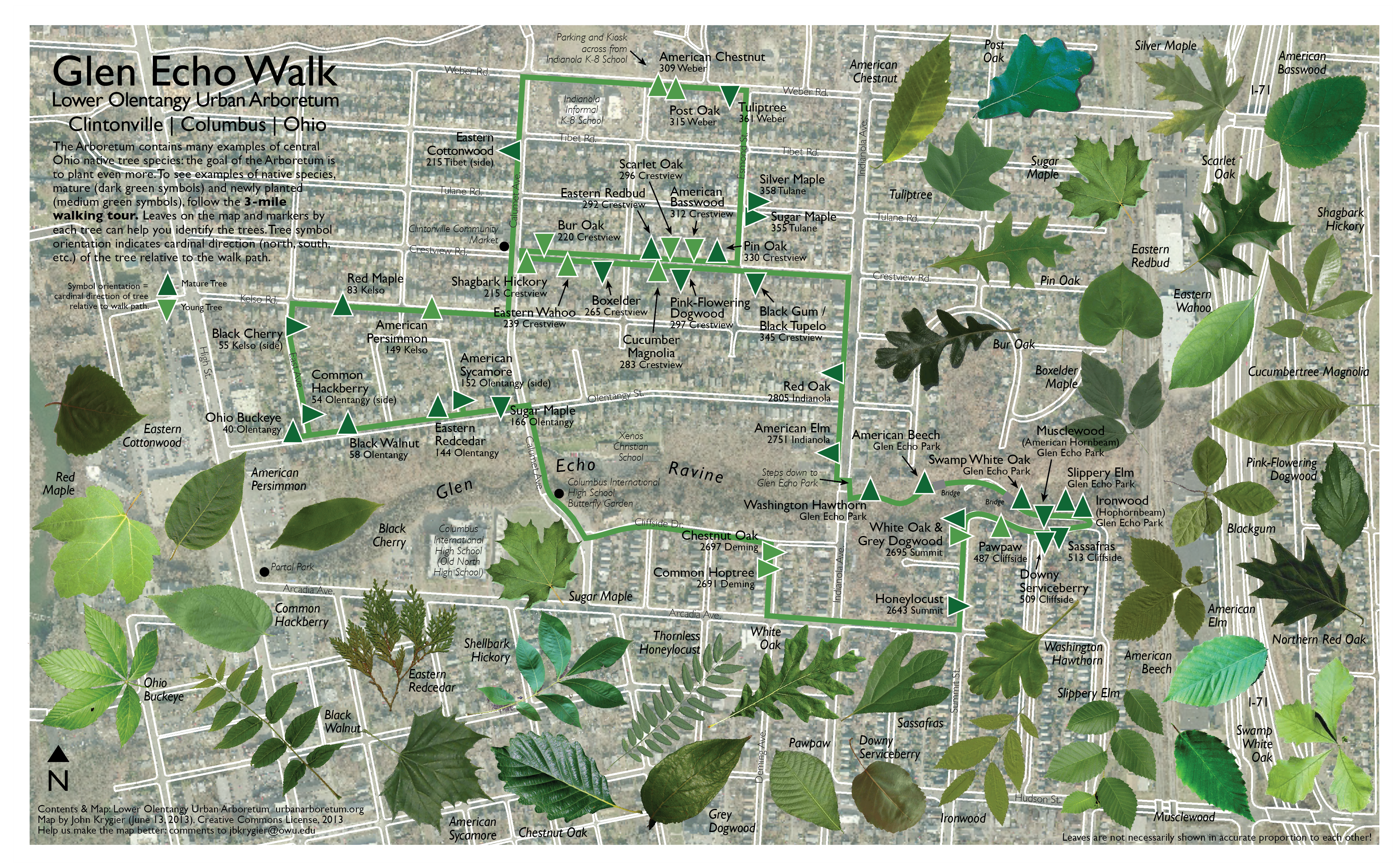
We have updated our two Arboretum walk maps, and digital copies are available here at the blog (in this posting and at the Maps tab above). A new printing of the maps will happen in the future, but for now only old versions of the walk maps are available on paper at the Arboretum kiosk.
For the time being, you can print the new maps yourself – legal size or tabloid. The latter, in color, costs a few bucks at a copy shop.
We added a few species of trees, replaced a few markers, placed the markers in Glen Echo Park, removed a few (now dead) trees from the routes, and added some additional information to each map; the color of the tree symbol indicates if it is newly planted or mature, and the orientation of the symbol shows which direction the tree can be found from the walk.
Please contact John Krygier (jbkrygier@owu.edu) if you have any additional corrections or comments on the maps.
Until next time!

